Image created by AI
NASA Unveils Ultra-Precise Eclipse Mapping Technique with LRO Data
In a giant leap for celestial cartography, NASA has refined the traditional methods used to generate eclipse maps, incorporating high-resolution data that dramatically increase their precision. These new maps have upended long-standing assumptions by accounting for the uneven topography of both the Earth and the Moon.
Whereas previous maps were limited by basic models of Earth at sea level and a simplified spherical Moon, advanced techniques now use detailed terrain information. This represents a significant shift in eclipse prediction technology, advancing from the two-century-old conventional approach.
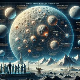
Ernie Wright, a visualizer at NASA's Goddard Space Flight Center, led the breakthrough by harnessing elevation data from the Lunar Reconnaissance Orbiter (LRO). By crafting a dynamic profile of the lunar limb, Wright could simulate the fluctuating contours of the Moon's shadow cast upon Earth's varied landscape. The LRO's observations have been critical, capturing the lunar surface in unprecedented detail, which makes it possible to reflect the real-time changes in shadow shape caused by lunar features.
The resulting visualizations are stunning and revealing. They portray the umbra, or the Moon's central shadow, in its authentic, time-evolving geometry, something never accurately depicted before. Contrary to the expected smooth oval, the umbra appears more akin to a potato, irregular and bumpy.
This new model displays how lunar topography—its mountains and valleys on the periphery—alter the shadow's edge. These uneven lunar features also give rise to phenomena such as Baily's beads and the diamond ring seen during a total solar eclipse.
The methodology behind these updated eclipse maps is akin to that used in 3D animation and complex system modeling such as weather forecasting. By computing one pixel at a time, the process achieves a level of precision comparable to breaking a problem down into millions of fragments—a task for which modern computers are particularly adept.
The innovative mapping technique not only enriches the data for scientific analysis but also serves a valuable educational purpose, providing the public and enthusiasts with a more accurate visualization of these celestial events. The advancements described in Wright's publication in The Astronomical Journal are thus poised to inform both the scientific community and the general public ahead of future eclipses.

